

Wheat Mapping
Posted 2021-02-22 14:02:40 by Chris Hill
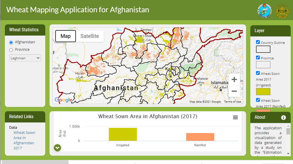
Estimation of Wheat Growing Areas in Afghanistan A wheat mapping workflow using Earth Observation data (Sentinel 1 and Sentinel 2) has been implemented in Google Earth Engine by ICIMOD in collaboration with MAIL. A web-based visualization system was developed to disseminate the final results. This provides summary statistics of areas of rainfed and irrigated what for the 2017 season.